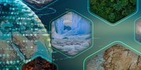
About
Humans have exploited forest biomass as a material and energy source for millennia, but population growth and increasing demand for resources have diminished the extent and condition of forests, including the amount of carbon they store and exchange with the atmosphere.
The Global Climate Observing System considers above-ground biomass (AGB) an Essential Climate Variable due to its functions as both a source of atmospheric CO2 (and other greenhouse gases) when forest is lost under Land Use Change or by degradation, and as a sink for CO2 due to forest growth.
Information on forest biomass can also play a much wider role in understanding and predicting climate, for example in model initialisation, model testing, estimation of carbon turnover, inferring the forest disturbance regime, and data assimilation in carbon cycle and climate models.
Objective
The primary science objective of ESA’s Climate Change Initiative (CCI) Biomass project was to provide global maps of above-ground biomass (Mg ha-1) for three epochs (2010, 2017 and 2018), with these being capable of supporting quantification of biomass change. For Phase 2 of the project annual mapping will continue creating a time series from 2015/16 - 2022, plus a 2005/7 epoch.
The mapping is at 100 m grid spacing with a target relative error of less than 20 per cent where AGB exceeds 50 Mg ha-1. Although this resolution is finer than required for current climate modelling, it will allow more refined information to be inferred (e.g. forest age structure and the disturbance regime) that is relevant for climate and has the potential to be exploited by carbon cycle and climate models as they develop.
About the project
To generate maps of biomass and biomass change, maximum use will be made of spatial data from past, current and future Earth observation missions. The products rely on ESA's C-band (Sentinel 1A & B) and JAXA's L-band Synthetic Aperture Radar (ALOS-2 PALSAR-2) with additional information from space borne LIDAR (e.g. NASA's Global Ecosystem Dynamics Investigation Lidar GEDI). The combination of these sensor types will allow information on the amounts of foliage and woody plant material and their distribution to be retrieved, both spatially and vertically, and over time.
The mapping will be achieved using algorithms developed within a globally consistent biomass retrieval framework and builds on the experience gained during ESA’s GlobBiomass Project. The quality of the maps will be extensively verified through the use of existing and new ground and airborne data sets. The resulting global biomass data sets will provide the carbon cycle and climate science community with the capacity to integrate global biomass layers into their models.
The major technical objective is to build on pre-existing methods for estimating biomass from satellite data (notably those developed during the GlobBiomass project), identify the weaknesses in these methods (arising from algorithmic, sensor or data issues) and address these issues using methodological advances that are applicable globally and consider different biomes. The project will also make significant advances in understanding how biomass data are used in carbon cycle and climate modelling, for example in model initialisation, model testing, carbon turnover time modelling and data assimilation.
Key Documents
Team
The ESA CCI Biomass team consists of leading scientists from 12 organisations in Europe. The project is led and managed by Professor Richard Lucas (University of Aberystwyth) and the Science Lead is Professor Shaun Quegan (Sheffield University).
- Richard Lucas (Project Manager) and Peter Bunting (Aberystwyth Univ., UK)
- Thuy Le Toan (Centre d'Etudes Spatiales de la Biosphère, France)
- Jérome Chave (Evolution et Diversité Biologique, France)
- Casey Ryan and Edward Mitchard (Univ. of Edinburgh, UK)
- Maurizio Santoro, Oliver Cartus and Andreas Wiesmann (Gamma Remote Sensing, Switzerland)
- Dmitry Schepaschenko (International Institute for Applied Systems Analysis, Austria)
- Christiane Schmullius and Carsten Pathe (Friedrich-Schiller-Universität, Germany)
- Philippe Ciais, (Laboratoire des Sciences du Climat et de l'Environnement, France)
- Oliver Phillips (University of Leeds, UK)
- Heiko Baltzer, Pedro Rodriguez Veiga, Polyanna Da Conceicao Bispo (University of Leicester, UK)
- Shaun Quegan (University of Sheffield, UK)
- Martin Herold (Wageningen University, Netherlands)
Contacts
To contact the CCI Biomass team email:
- Scientific leader: Shaun Quegan
- Project manager: Richard Lucas
- Assistant Project Manager: Heather Kay
- ESA Technical Officer: Frank Martin Seifert
Data
The primary science objective ESA’s Climate Change Initiative Biomass project (Biomass_cci) is to provide global maps of above-ground biomass (Mg ha-1) for four epochs (mid 1990s, 2007-2010, 2017/2018 and 2018/2019), with these being capable of supporting quantification of biomass change.
All datasets are available via the CCI Open Data Portal
You can also directly access the Biomass_cci project's latest product (v3) here:
Global datasets of forest above-ground biomass for the years 2010, 2017 and 2018, v3
This dataset comprises estimates of forest above-ground biomass for the years 2010, 2017 and 2018. They are derived from a combination of Earth observation data, depending on the year, from the Copernicus Sentinel-1 mission, Envisat’s ASAR instrument and JAXA’s Advanced Land Observing Satellite (ALOS-1 and ALOS-2), along with additional information from Earth observation sources. The data has been produced as part of the European Space Agency's (ESA's) Climate Change Initiative (CCI) programme by the Biomass CCI team. This release of the data is version 3. Compared to version 2, this is a consolidated version of the Above Ground Biomass (AGB) maps. This version also includes a preliminary estimate of AGB changes for two epochs. The data products consist of two (2) global layers that include estimates of: 1) above ground biomass (AGB, unit: tons/ha i.e., Mg/ha) (raster dataset). This is defined as the mass, expressed as oven-dry weight of the woody parts (stem, bark, branches and twigs) of all living trees excluding stump and roots 2) per-pixel estimates of above-ground biomass uncertainty expressed as the standard deviation in Mg/ha (raster dataset). In addition, files describing the AGB change between 2018 and the other two years are provided (labelled as 2018_2010 and 2018_2017). These consist of two sets of maps: the standard deviation of the AGB change and a quality flag of the AGB change. Note that the change itself can be simply computed as the difference between two AGB maps, so is not provided directly. Data are provided in both netcdf and geotiff format.
Please find the previous version (v2) here:
Global datasets of forest above-ground biomass for the years 2010, 2017 and 2018, v2
This dataset comprises estimates of forest above-ground biomass for the years 2010, 2017 and 2018. They are derived from a combination of Earth observation data, depending on the year, from the Copernicus Sentinel-1 mission, Envisat’s ASAR instrument and JAXA’s Advanced Land Observing Satellite (ALOS-1 and ALOS-2), along with additional information from Earth observation sources. The data has been produced as part of the European Space Agency's (ESA's) Climate Change Initiative (CCI) programme by the Biomass CCI team. The data products consist of two (2) global layers that include estimates of: 1) above ground biomass (AGB, unit: tons/ha i.e., Mg/ha) (raster dataset). This is defined as the mass, expressed as oven-dry weight of the woody parts (stem, bark, branches and twigs) of all living trees excluding stump and roots 2) per-pixel estimates of above-ground biomass uncertainty expressed as the standard deviation in Mg/ha (raster dataset). This release of the data is version 2, with data provided in both netcdf and geotiff format. The quantification of AGB changes by taking the difference of two maps is strongly discouraged due to local biases and uncertainties.


1st User Workshop - Phase II
User Workshop | 28-30 June 2022 | Virtual
The first CCI Biomass User Workshop to discuss biomass and biomass change datasets with a consolidation of users requirements will have three sessions 1500 to 1700 CET:
28th June - Session 1 - Mapping Global Biomass
29th June - Session 2 - Needs from national users
30th June - Session 3 - Biomass change and climate users
Agenda
- View the meeting agenda